 |
|
|
|
Virtual Tour of the North Road
Page 1 of 1
|
|
|
|
The North Road is a very remote road that runs from near
Chibougamau to Km 275 of the James Bay Road.
It is 424 km long, and is a modern gravel road, with smooth curves and hills,
unpaved for its entire length. There is very little traffic - most of the
traffic is trucks. The first 50 km or so are used by mammoth logging trucks. Use
caution! There are numerous warning signs about them. There are no towns on the
road except for Nemaska, which is 10 km
north of this road at km296.
If the road is dry, expect a complete whiteout after a truck
passes you. Slow down and pull to the right as far as you can safely go.
This will help preserve your front windshield, as well as keep you out of the
way if the oncoming driver does not pull over to their side of the road far
enough. Generally speaking, the truckers to be very considerate of the
other vehicles on the road. It's the occasional passenger vehicle and
pickup truck being driven by a maniac that are the problem. Watch for
graders that are continually working on the road.
Generally the scenery is fairly level (some people will say
it's downright boring). The road crosses some medium-sized rivers. The
road is open year-round, however, it gets VERY cold up there in the winter, so
if you go in the winter, or even the fall or spring, be prepared. In the
summer it can get just as hot as down south. There are regular picnic and rest
areas to stop and take a break. There is only one campground. You may
instead to choose to camp in old gravel pits, which are plentiful and usually
not all that ugly. Cell phones do not work here.
I don't have many photos of the North Road. I've only been
along it once. I fully intend to go back soon, and when I do, there will be a
lot more photos here.
See also
Travelogues, Driving the North Road.
|
|
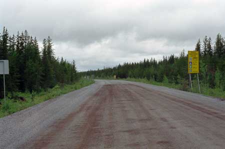
Km 0: Beginning of the North Road, starting about 15 km north of
Chibougamau, off Hwy 167. |
 |
Km 10: Graders are
constantly working this road. Be on the lookout for
them. |
|
|
Km 11: Backroad to Chibougamau, logging road
mainly, but not every day Km 12:
Waconichi Lake. There is a "Northern Arboretum" there, quite
interesting to walk in the forest.
SEPAQ have some very nice camps there. (SEPAQ is the "Société des
éstablissements de plein air du Québec")
Km 20: The small Barlow River. CAUTION: The bridge
here is very narrow and when there are logging trucks on the road,
you might have to stop very quickly just before the bridge for them
-- this is dangerous if there are some more behind you!
Km 26: Backroad to Oujé-Bougoumou and Chapais --
some 46 Kms for Oujé, and 11 more for Chapais. |
 |
Km 27: Mammoth
logging trucks frequent the first 50km or so of this
road. Keep an eye out for them, and pull over when you
see one coming (keep moving slowly, though). |
|
| Km 32: Access road to Baie Penicouane, the
southern part of Mistassini Lake. SEPAQ campground there, boat ramp,
picnic tables. Km 63: Brock River
Km 65: There is a spring on the left side
(northbound) of the road here.Km 66: Samuel Bedard
Lake |
 |
Km 72: It is a
well-maintained, smooth, modern gravel road. But read
Driving the North Road
page if you choose to travel up here. |
|
Km 77: Beaver Camp (road maintenance camp). Also
access to the Lake & River Des Maures.
Canoeing: From there you can reach the Rupert River & Mistassini Lake by
canoe, and then paddle down the Great Rupert!! Or stay on the "South
branch", the Natastan River until Lac de La Passe, portage your way
through the Marteen River waters and paddle back to the road at Km 177.
Or keep going over the Natastan River until the end, paddle all Lac
Mesgouez and come out at Km 221.Km 81: Domergue Lake |
 |
Km 83 |
|
| Km 98: Regneault Lake Km 100: Frotet Lake
Km 106: Cellular phones do work here for a short
ways.
Km 108: Junction of access road for the
Troilus Mine, 44 Kms away.
At about km 27 of this access road, there is a gravel pit, just over
the hill after crossing the Broadback River. This is the access for
"Square Tail Lodge" outfitting camps. This is A world Class fishing
spot, for speckled trout mainly. So far, at least 3 world records
come from this camp. The biggest trout ever caught at the Lodge
since opening in 1966 was 9 pounds & 9 ounces. This record catch was
exceeded in 2004 with a trout weighing 12 pounds & 1 ounce!
The road turns west just after Km 108; there is a nice valley on the
north side of the road. Lake Lezai is visible down there, quite
pretty scenery with all the small islands in the lake. |
 |
Km 115 |
|
Km 118: Tortigny River
Here the road turns back North. Just at the curve,
there is a sideroad on the left side to Cachisca & Opataca Lake.
This road used to be another way to come up here, via Chapais &
Oujé-Bougoumou, following the power lines for most of the way. In
1999 this sideroad road was completely washed out after the
tremendous winter of 1999 (over 9 feet of snow!). When the
Mistassini Lake ice melted away (headwaters of the Rupert River),
the Rupert River water level went up 5 feet and stayed like that
until the summer of 2000! The water level was even higher in 2004,
due to Mistassini Lake ice again. The ice went out only on June 20th
of 2004. The water level was already quite high but it went up
another 3 feet!Km 131: Broadback River:
This river may also be seen at Km 232 of the
James Bay Road.
Km 132: Cheniapiscau rest area. Picnic tables,
toilets, scenic viewpoint, camping.
Camping & fishing note: This campsite and any other
campsite before Km 164 are inside the SEPAQ territory. You need to
register and pay for camping or any other activities inside the
Reserve. No registration paper might mean a fine from the Quebec
Game Wardens. They are all over the place in the summer. Same thing
for fishing. First "free" fishing spot is the Marteen River at Km
178.
Km 154: Limit of the logging operations! Breathe a
big sigh of relief!
Here there is a road on the left side. Just past this (northbound),
there is a steep hill. Stop here! Get out of the car, climb up the
rocks on the left side (northbound) and have a look at the scenery!
When the air is very clear, you can see all the way to Km 108. And
if you are familiar with the area, you can clearly see the Troilus
Lake mountain, this is more than 60 Kms away!Km 162:
Entering the areas of Assinica, Albanel-Mistassini and Waconichi
Games Preserves. 1-800-665-6527
Km 177: Marteen River. By paddling
downstream from here, you can reach the Rupert River after a week or
so of paddling.
Km 221: Small side road on the right hand side
(north bound): access for Mesgouez Lake & the Rupert River. There is an
extensive set of Cree camps here (spring fishing camps). Boat ramp,
camping, fishing. |
 |
Km
232
Southern limit of the WEE-SEES-INDOHOUN Game Management
Territory. New in 2003. You will need a pass (free) to fish or camp
anywhere inside this special zone. Pass can be obtained at the SEPAQ
office at Mont Chalco, just about 5 Kms North of Chibougamau or at the
Nemiscau Quebec Hydro camp (Km 290). |
|
Km 238:
Rupert River Gorge.
STOP HERE AND TAKE A LOOK. Picnic
tables, toilets, shelters, fishing. Spectacular rapids!! It isn't
anywhere near as big here as it is downstream where it crosses the
James Bay Road. But these rapids are a seething mass of wild
roaring water nonetheless.
There are plans to divert the
Rupert River,
upstream from here, in 2007. Get up here and see this magnificent
wild river while it is still unaltered!
It is possible to camp here, but NOT at the rest area. Just before
the bridge (Northbound), on the right side, there is a small road.
This is the portage trail. There is room down there for 1-2 cars &
tent. But if you try this, you may not sleep well during the first
night ...this rapid is loud
The "cut-off" point for the Rupert River Diversion
project is only about 4-5 kilometers upstream. At low water, it is
possible to walk on the North shore of the River and reach this point,
about a days walk.
To have another view of the Rupert River, one can walk
North on the road for +/- 300m -- there is a trail there. This is the
portage trail, ends in a nice "pool", where there's a nice view of the
second set of rapids (Class V).
There is also another trail. Just in front of the
entrance for the small road (the portage trail mentioned above), at the
south side of the bridge. This trail leads right on top of the chute,
one can take breathtaking pictures from there. But take great care, it
is almost scary!
Same note here about fishing, you are in the
WEES-SEES-INDOHOUN zone, so you need a pass.
|
|
|
|
 |
|
|
|
 |
Km 238: Bilingual
stop sign at rest area: French and Cree. |
|
Km 248: Hydro Quebec transformer station Albanel
Km 255: Hutte Lake Km 258: Junction:
Left turn for the Route du Nord.
Right turn for the Hydro Quebec Poste Albanel transformer
station.
Straight ahead is the "Auclair" road, for a 4x4 only. Leads to the
Nemiscau River (38km) & the Eastmain River (68km). |
 |
Km 285 |
|
| Km 286: Lescar Hills rest area. Picnic tables,
toilets, scenic viewpoint. Km 288: Hydro Quebec Nemiscau
transformer station.
Km 290: Cree Construction Garage. Gas and diesel might be
available from 7-9am and 4-6pm, Monday to Saturday, closed on
Sunday. But you're probably better off going into
Nemaska for this.
Km 300: Access road to the village of
Nemiscau (Nemaska), 10 km
to the north. Gasoline, diesel, restaurant, store, lodging (819)
673-2512. |
 |
Km 330 |
|
|
Km 354: Turnoff for Lake Nemiscau & Old Nemaska. The
Cree village used to be there until 1970 when the HBC closed the post
and the people were "evacuated" by Quebec-Hydro. "New Nemaska" is at
Lake Champion (km 300). Km 381: Boisrobert Lake.
Picnic tables, toilets, boat launching ramp, camping. |
 |
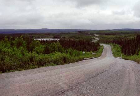
Km
406: End of the North Road: junction with the
James Bay Road
at km 275. This photo is looking east along the North
Road at the junction. |
|
 |
Km 406: Rest Area
at the junction. |
|
 |
This is on the James Bay
Road at Km 275, at the junction with the North Road.
The James Bay Road is paved, which will be a welcome
change after 406 km of gravel road!
This concludes the Virtual Tour of the North Road. |
|
|
|
|


