James Bay Road website

July 2000 trip

Page 2 of 5
Previous    Next

James Bay Road


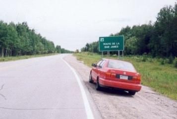
This road was built in 1972 to facilitate the construction of the controversial James Bay Quebec Hydro project.  It was specially built to accommodate very heavy equipment (up to 500 tons).  Built in 420 days, it is paved all the way.

Although I came up the North Road from Chibougamau, and therefore started to travel north up the James Bay Road from km274, I have arranged the photos and travelogue in "road order".  That's why sometimes you'll see rain in one picture and sunshine in another, even if the pictures are of the same place, or a short distance from each other.

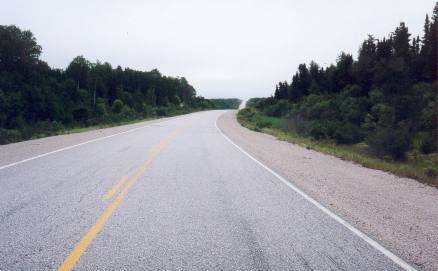
The country here is not spectacularly scenic like the Rocky Mountains.  It is mostly gently rolling country or flat.

Please note that this travelogue is not designed as a guide to the James Bay Road
CLICK HERE for a detailed guide


km 0
The James Bay Road starts at Matagami.  This is the last town you'll see for 620km (375 miles)!!

To give you an idea of how far north this road is, Matagami is 920 km north of Toronto, and 6 hours north of North Bay.

Stock up on what you need for the trip, especially gas.  There's only one gas station between here and the end of the road.


km 6
Checkpoint
: Because of the remoteness of the country that the road travels through and the lack of services, they like you to stop here and tell them who you are and where you're going, especially in the winter.
km 120
Much of the first 200 km or so of the road looks more or less like this.

km 232
Broadback River
crossing, the first of the huge northern rivers that you'll cross.
This is the general area where the land changes.  From here north, the road traverses the ancient (now dry!) Tyrell Sea.  Most of the trees are black spruce, jack pine and tamarack, growing in sandy soil.

km 257
Rupert River crossing. The rapids here just east (upstream) of the bridge are absolutely awesome.  Definitely stop and have a look.  They are the most awe-inspiring rapids I have ever seen.

The Rupert River splits to go around the island.  To get a sense of the massive scale of these rapids, observe the size of the full grown trees on the island.  Also keep in mind that the water going down these rapids isn't only a few inches deep.  It is several feet deep.

Previous    Next

The material on this page is copyright © by the original author/artist/photographer. This website is created, maintained & copyright © by Walter Muma
Please respect this copyright and ask permission before using or saving any of the content of this page for any purpose

Thank you for visiting!